The repopulation of the Greater New Orleans area may be starting in West Jefferson, with a proposed 20,000-home development on the “Churchill Farms tract, part of a 9,393-acre swath that extends east about nine miles from the St. Charles Parish line.”
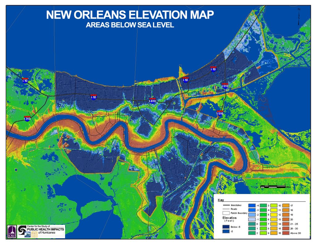 OK, here’s an elevation map of the GNO area.
See all the blue in West Jefferson? Looks a lot like the blue in New Orleans East that got flooded by the storm surge from Katrina, doesn’t it?
Now, imagine that Katrina goes west of the Mississippi. The storm surge goes west, too. Would it reach West Jeff? I hope not. But, if I am reading this Hurricane Pam graphic (pdf) right, that area gets over 10 feet of surge in this fictitious Category 3 scenario.
But wait, there’s a levee (same article):
Plans call for the levee to be widened and raised to 10 feet to protect against a fast-moving Category 3 storm by next hurricane season, said Cahill, who has complained in recent months that some parts of West Jefferson's overall levee system would not stave off a "Category 0" storm. He added that Category 5 protection could be achieved at Cataouache for $10 million to $20 million from federal coffers.
“[W]ould not stave off a ‘Category 0’ storm.” My head hurts. Nevertheless, welcome to the West Bank.
And, speaking of blue, look at all the blue in East Jefferson west of the 17th Street Canal. If you live there, you need to be as vocal as New Orleans residents in demanding improved levees.
2 comments:
The West Bank is screwed -- the Harvey Canal is a mish-mash of homemade levees that came within a foot of overtopping during Rita -- and Rita wasn't even that strong here.
I don't hear a lot of JP people screaming, but they damn well ought to.
Very cool elevation map. I think I can see Monkey Hill at the Zoo, and the Berm at Zephyr Field.
Post a Comment